C-MAP NA-Y073 Max N+ microSD
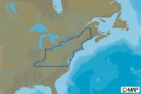
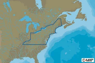
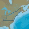
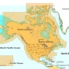
Northeast US Lake Insight HD
Model: M-NA-Y073-MS
- Full Featured Vector Charts – C-MAP MAX-N+ provide boaters with the accurate, up-to-date vector chart detail including Depth Areas and Contours, Spot Soundings, NavAids, Light Sectors, Wrecks/Obstructions, Small Craft Facilities and more.
- Harbor and Approach Details – The detail and information available with C-MAP MAX-N+ charts lets boaters approach any harbor and inlet with confidence — the perfect conclusion to a long voyage, sailing adventure or exciting day of bluewater fishing.
- C-Marina Port Database – C-Marina Port database and detailed marina charts in C-MAP MAX-N+ provides useful, categorized information for cruisers, fishermen and sailors — including Port Layout and Facilities, Operating Hours, Accessibility, Phone/Email Contact Info and more.
- Easy Routing – Automatically plots the shortest, safest route based on detailed chart data and vessel information. Easy Routing quickly takes two points and generates a suggested route, while highlighting potential dangers such as shoals, sandbars, submerged rocks and other obstacles.
- Detailed Marina Port Plans – Docking in an unfamiliar port is no problem, when you have precise layouts of thousands of marinas, including slip spaces, restricted areas, and other valuable navigation information.
- Dynamic Raster – Traditional “paper chart” look with unique ability to access information on buoys, lights and other details.
- Satellite – High-resolution satellite imagery provides real-world reference, enhances situational awareness for coastal navigation.
- High Resolution Bathy Data – The highest available detail of underwater pinnacles, ledges and canyons that are magnets for offshore and coastal gamefish.
- Sport Fishing Data – Provides angling intelligence for wrecks and reefs, Fish ID photos, fishing tips, updated regulations, state records and more.
- Aerial Photos – High-Definition Photos & Diagrams of ports, marinas and significant navigational marks.
- Custom Shaded Depths – Shaded depths make it easy to distinguish different water depths.
- Multi-Language – Display charts in both English and one of 19 local languages currently available.
C-MAP MAX-N+, designed for Lowrance, Simrad and B&G chart plotters, is packed with advanced features, including: Dynamic Raster Charts, Tides & Currents, C-Marina Port Info, Custom Shaded Depths, High-Resotlution Fishing charts, 3D-View and more.
Whether you’re an avid saltwater angler, sailing enthusiast or long-range cruiser, these powerful charts will enhance every moment you spend on the water.
With huge coverage areas, up-to-date data and state-of-the-art features, no adventure is out of reach.
Specifications
| Publisher | C-MAP by Jeppesen |
| Class | Lake Insight HD |
| Media | Micro SD Card with SD Adapter |
WARNING: Cancer and Reproductive Harm – www.P65Warnings.ca.gov.